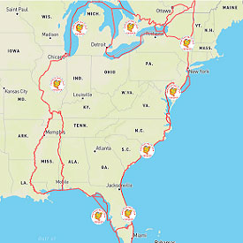
As you can see from the map, there is a big 6000-mile loop that we will follow with optional routes or side trips along the way. Generally, folks follow the seasons: Florida in the winter, up the East Coast in the spring, Canada and the Great Lakes in the summer, and down the rivers in the autumn.

Capt John’s Interactive Great Loop Map. This interactive map makes a fantastic route and trip planner. It is a great tool for planning your cruise around America’s Great Loop. It’s free – enjoy!
